Dit d'Oltá
Country:
Range: Sierra de Oltá
Elevation: 587 masl 0K
Summit (Latitude, Longitude): 38.660953, 0.014954
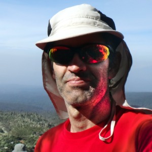 Enrique Cartagena
has summited Dit d'Oltá 1 time
Enrique Cartagena
has summited Dit d'Oltá 1 time
Clásica circular [es | en]
|
|
|
|
|
|
|
|
|
| Total | |||
|---|---|---|---|
| 3.92 km | 6.2 km | 10.12 km | |
| 1h 26min 41s | 1h 48min 5s | 3h 14min 46s | |
| 2.71 km/h | 3.44 km/h | 3.12 km/h |


[Español]
Subida al Dit d'Oltá (587 m), cima mas elevada de la sierra d'Oltá.
La ruta empieza en la zona de acampada y sigue el circuito principal identificado como PR-CV 340. En todo momento encontraremos carteles indicando el camino.
Ruta sencilla, que transcurre en gran parte entre pinos y con fantásticas vistas de la costa, en particular de Calpe y del Peñón de Ifach.
__________________________________________________
[English]
This track summits Dit d'Oltá (587 m), which is the highest point of Oltá mountain range.
The route starts at the camping area and follows the main circuit identified as PR-CV 340. We will find signposts all along the route showing us the way to the top and around the mountain.
This is an easy route where we will find lots of pine trees and fantastic views of the coast, mainly Calpe and Peñón de Ifach.