The Hump
Country:
Elevation: 1067 masl 1K
Summit (Latitude, Longitude): -46.107551, 167.326913
 Enrique Cartagena
has summited The Hump 1 time
From Rarakau car park
|
|
|
|
|
|
|
|
|
| Total | |||
|---|---|---|---|
| 17.18 km | 17.22 km | 34.4 km | |
| 4h 42min 50s | 4h 7min 25s | 8h 50min 15s | |
| 3.65 km/h | 4.18 km/h | 3.89 km/h |
This hike starts at Rarakau car park. This is the same place where the Humpridge track, the New Zealand Great Walk, starts. In fact, the first 7 kilometres of both tracks are in common.
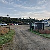
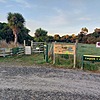
For parking at Rarakau car park you are expected to leave a donation at the green box located at the car park. A guy from the Humpridge track organization told me 5 NZD is a good figure.
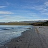
300 meters from the car park we find the beginning of the track. The first part we walk inside a forest for about 3 Km when we go down a section of stairs and then we get to the Waikoau bridge. Once we cross the bridge we get to the beach. This beach section is almost 3.5 Km and you can choose to walk either on the beach or on the track that goes parallel to the beach. This hike does pieces of each of them depending on which one I found easier at that moment.
Once we get to the end of the beach we get back to the track and 500 meters on the track we find a house where we depart from the Humpridge track. At this spot we make a right and follow the 4WD road to Teal Bay. This section of the hike is very easy and the slope is quite gentle. We follow this road for about 4.5 Km where we find a small signpost with the word "Track" and a big orange triangle indicating where to get in. I added a waypoint to the gpx track with the name "Leave 4WD road to track" to indicate this spot.
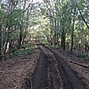
Up until this point the track has been very easy and the progress very fast. Things change dramatically here. The 4WD road turns into a steep narrow track with lots of fallen trees and mud. Expect your speed to decrease quite a bit. Mine decreased to half.
On the bright side, the track is well-marked with orange triangles. Only two or three times I found it hard to spot the next one and got a bit off-track for a few meters.
We keep walking on this narrow track and after about 3.5 Km we get to a first high point where we briefly get out of the forest and have a glimpse of the mountain we are trying to climb. Here you realize that to get to the summit of The Hump first you have to go down, then go up on another mountain, then down again and only then you start the final ascent to The Hump. You have been walking for 15 kilometres, there are only two more kilometres to the end but still quite a good effort in front of you. Don't let this demoralize you as it did to me since I didn't know about it beforehand.
From 835 meters of elevation we start walking down back on the bush. We keep walking until we reach the 784 meters mark. 52 meters of elevation loss doesn't sound like much but you feel it when going up all the way to the 965 meters mark totalling 179 meters of elevation gain. This part is the one that I found the hardest. The track is not marked, it is quite steep and has lots of vegetation. Although there are no orange triangles from DOC I found a few orange poles that more or less indicate the way to go.
Once at the 965 meters mark we are out of the forest and looking to the right we have a clear and direct view of The Hump and the ridge to get to the summit. We don't need to continue to the top of the mountain we are on, at this spot we turn right 90 degrees and start going down towards The Hump.
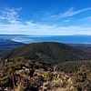
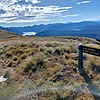
This last kilometre is only marked with orange posts on a straight line although it's not always easy to spot them among so much vegetation. The views from this point on are spectacular. On our right we have the coastal line, from Te Waeway Bay all the way to Bluff. We can even see Stewart/Rakiura island.
We go down 45 meters and start walking the last 149 meters of elevation gain that separates us from the summit. 400 steep meters that leave us on a flat area where we walk the last 150 meters to the highest point, The Hump summit, at last!
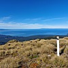
At the summit we find a DOC signpost indicating that you can continue for another 3 hours and get to Hauroko lake.
From here the views are even better than the ones we had so far. We can see the whole Hump ridge, the coast line and looking north we see Hauroko lake surrounded by mountains.
To get back we return following the same track that took us here, keeping in mind that we have to go down and up again as we did to come up here. This time is easier since we go down many more meters than we go up.
In summary, this track is easy for the first 11.4 km, until you take the single track, and a lot harder from that point on and for about 5.8 Km to the summit. It is a very long track, with lots of mud on the second section and don't forget the two final down/up sections that can demoralize you if you are not prepared for them.
Another thing to keep in mind is that you won't find any water along the way. What I did was to take an extra bottle of water and, to avoid having to carry it all the way up and down, I hid it at about the 10 kilometres mark. This way I had 1.5 litres for the final 10 kilometres.
